 Sunday 13th May, Mothers Day. Before leaving
Palmerston we went to the shops & they were handing out orchids & chocolates to
the women for Mothers Day & two boxes of maltesers to all the guys (they got
that right!). (I think by now you’ve
worked out that Phill’s narrated this post!) Shopping done & it’s time to leave
city life and head to the bush. 70k’s south of Palmerston we turned right &
into Batchelor & had coffee & bikkies while watching the locals at the
Mothers Day markets.
Then after a quick check with the information centre we
head for Wangi Falls camping grounds; the only
campsite you can take caravans to in Litchfield National Park. Litchfield is only about 130kms
south of Darwin & it’s really accessible. A lot of Darwin residents go there for day or
weekend trips; lucky them! On the way in we stopped at the Magnetic Termite Mounds for a
gander. They're pretty big!
 After a few photos we moved on to Wangi Falls to set up camp for a
couple of days. We were pretty impressed by the campgrounds. In a lot of national parks they have the very minimum of facilities but most of the N.T. ones have 'real' toilets (not drops), hot showers & bbq's; they're pretty good. We headed down to the falls to find a fantastic swimming hole
at the base of the falls but 'no swimming’ signs & barriers up everywhere. Still closed for the wet
season; there might be crocs. Bugger. So we headed off on a 3.6km walk up over the top of
the falls & back down where we sat & talked to a couple who were sitting there relaxing while enjoying the falls. They're only 50 & already retired! Jealous!
Top spot but pity about the swimming, so back to the
van and happy hour then dinner & sleep.

Up bright & early and off to see some more of Litchfield N.P. First up we went to Walker Creek. It has 8 little campsites along the creek but you’re only supposed to swim at no.6 ‘cos you might disturb the campers. On the way up we went to them all to have a look & they were all really nice; right on the creek & only one had someone camping at it.
It was pretty hot so we were glad to reach no.6 where we could finally get wet. The waterfall was only small but you can't beat swimming at the base of a waterfall. After cooling off we finished off the walk up to the last campsite then headed back & stopped in at no.3 for another dip as there wasn’t
anyone there.
Back to the truck to move on up to Bamboo Creek Tin Mine.
Something different; a look back in time at how life was in the 40’s &
50’s. All that’s left are relics of broken machinery but it was very
interesting indeed. There were little bits of tin all over the ground & in
the rocks but it isn’t viable to mine it anymore. Pretty sad story; most of the people who worked
there died from tin poisoning.
 From there we drove back to the Cascades. As we walked in we decided to take the short 700mtr walk as the longer walk didn’t look worth it. It was really nice walking through the rainforest along the creek, but we met up with an older couple who told us we should have taken the 1.2km walk up the other side & then done the short walk back. So then we got to Curtain Falls where the water was crystal clear & jumped in to cool down again.
Then we headed up the cascades to the top where we
found a sign saying ‘Carpark 2km’ so we did what they'd suggested & headed off for a lovely walk through more rainforest. Wrong again and we
cursed that old couple for the next 1 ½ kms of hard slog up & down the hill
on slippery rocks in the midday sun before we made it back to the creek &
some shade. As much as I'm showing the beautiful photos of all the waterfalls & plunge pools & that, the thing I'm not showing is all of the bush we have to walk through to get to them! It's not all fun & games you know!
 We decided to go down to Blyth Homestead & Sandy Creek Falls this afternoon but low &
behold the road is closed due to late summer rains. Most of Litchfield is
bitumen but there are these side tracks that are 4wd only & they’re all
still shut. So we headed on up to Greenant Creek and a 2.7km walk up the creek
to the top of Tjaetaba Falls. They’re quite amazing; about an
80mtr drop but because of it being an indigenous sacred sight; no swimming was
allowed so we threw our clothes in the water instead & put them back on wet to cool
off before starting our walk back to the truck. Wonder if they'd complain about that?
 From there we went to Tolmer Falls, about 2 k’s up the road from
Greenant Creek. It was only an 800mtr walk down a concrete path to a lookout
across from the falls (it would have been great to get down into the gorge
& walk it). You could see across to where the water has gouged its’ way
through the rock before falling a long way to a pool below. But, again no swimming. After admiring the falls we headed back to the van for drinks & a yummy pork roast cooked on our new barbie.
Rise & shine, brekky finished & packed up, it was
time to move on back towards Palmerston because JJ couldn’t resist the crackling
from last night’s dinner and she broke one of her teeth. So off to a dentist.
 On the way out of Litchfield there were two falls left to
do. First we went to Florence Falls, parked the van and headed down
the 1.2km walk via the carpark to the falls.
We were commenting on the pathways as
we walked & how good they were then we came across some steps and we couldn’t believe them.
They went all the way down to the bottom of the gorge; they were pretty impressive. Unlike
Western Australia where we had to scramble down rocks & trees to get down,
here we had steps to walk down to a magnificent plunge pool at the bottom of
the falls.
.JPG) There were dozens & dozens of people young & old swimming
& sightseeing. JJ had to go for a swim so I thought I would as well but
when I got to the water’s edge JJ had returned & announced the water was
freezing so I back paddled & got dressed & watched everyone else turn
purple. After many photos of the falls we headed down the creek walk back to
the van.
There were dozens & dozens of people young & old swimming
& sightseeing. JJ had to go for a swim so I thought I would as well but
when I got to the water’s edge JJ had returned & announced the water was
freezing so I back paddled & got dressed & watched everyone else turn
purple. After many photos of the falls we headed down the creek walk back to
the van.
 The shady creek walk was the highlight of Litchfield for us; breathtakingly
beautiful palm trees, ferns, little waterfalls. Money couldn’t buy the beauty
of that walk along the creek. It was just the sort of surrounds you’d love to
live in; just about what we've always dreamed of for our backyard. Look at the reflections in the water; it's all spring fed from the tablelands & so clean & clear you can drink it.
 As we returned to the van, one to go; Buley Rockhole. Definitely not for
caravans, signs everywhere as you drive in, ‘No Caravans’, but we went in
anyway and we found out why; nowhere for busses or caravans to park so we drove
back about 1 km before we found a place to park off the side of the road and
walked back. Very pretty cascading falls; about 10 or so different drops down
the side of a hill with little swimming holes after each drop. Again, dozens of
people scattered up & down the rockpools. Again, JJ swam while I watched (I
don’t like cold water). (neither do I but how can you resist when it's about 33 degrees & there's this beautiful natural pool in front of you? It doesn't matter how cold it is!)
After her swim we walked back to the van and headed
into Batchelor for lunch. That’s Litchfield National Park finished. We certainly saved the
best for last with Florence Falls. Nature at it’s finest.
 A young couple we met over in W.A. 2 years ago told us that Lawn Hill National Park is the most beautiful place they've ever seen. Gee, that's a big call to make. A few other people have also told us it's beautiful. Well, we're now there & we agree; it's beautiful but we wouldn't say the MOST beautiful . I don't think either of us can actually point at any one place we've seen & say that it's the MOST beautiful. But, in saying that, it's definitely one place we're glad we came to & one we'd recommend to others.
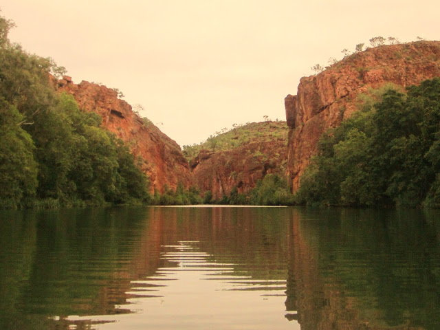
 Lawn Hill is beautiful in parts & ugly in others. During the wet the creek is flooded & now, in the dry there are the remnants of the floods; huge piles of dead palm leaves & trees that have been knocked over & many others with no soil left around them & are only holding on by their roots. You could almost make a horror movie in one part of the lower gorge; it's kind of eerie. It's full of tufa formations which are a form of limestone & apparently very significant in geology but they're really ugly! It's something to do with the fact that it's all spring fed.
 Then there are the other parts; the middle gorge is beautiful. The only way to get all the way up the creek is to paddle so that's what we did. You paddle up the first part of the gorge to the Indarri Falls which are also made up of tufa but they're beautiful. There are about four drops. You can swim there but it was way too cold today; the sun had a bit of a problem coming out. (We've left the beautiful weather back in the Northern Territory.) When you get to the falls, you have to carry your canoe to the top gorge & you can then row up to a part where there must be springs all over the place; there's water coming from every direction & it's pretty warm but I still only had a paddle.


.JPG)


.JPG)


.JPG)


.JPG)


